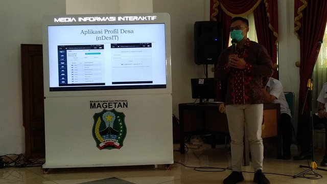
Muhammad Kamil in the presentation session. (Photo: Special)
Wednesday, December 12, 2021, at the Magetan Regency Regent's Office, UMM IP Study Program had the opportunity to present some of its academic excellence. In front of the Magetan Regent, along with all Regional Apparatus Organizations (OPD), Camat and Village Heads in Magetan, UMM IP Study Program through Muhammad Kamil, S.IP., MA as the Head of Study Program presented two advantages that are currently being developed, namely the Center of Excellent (CoE) and electronic-based information management and data processing applications, namely Geographic Information System (GIS) and Ndesit.
Muhammad Kamil briefly and clearly explained all these advantages. First, CoE is one of Merdeka Learning Merdeka Campus (MBKM), which requires every study program to create and develop research-based centers of excellence based on their disciplines. It is hoped that this CoE will contribute to students and alumni and other relevant stakeholders (government and non-government agencies). "Government Science UMM Malang translates CoE in the form of a Government and Political Analyst school which is then divided into three sub-classes, namely Governance Analyst, Village Government, and Youth Parliament. One of the big goals is to become reliable analysts and practitioners in these three fields. All of these classes are planned to be implemented in the next 2-3 months and are currently in the process of finalizing the technical concept, “explained Kamil.
Second, GIS and Ndesit applications. The UMM IP Laboratory specially developed these two applications. GIS is a data information management tool that is very useful for making policies related to spatial problems in an area. GIS can accelerate data analysis to be more efficient and effective in analyzing an area. GIS, which is usually in the form of a map, can help local governments, for example, to know the size and distribution of residential areas, industrial areas, agriculture, land distribution, development of transportation networks, and mapping and monitoring of points prone to natural disasters. Second, e-Ndesit. Ndesit is an electronic-based village information system that contains real-time profile data and village asset management. E-Ndesit, which is currently in the finalization stage, is expected to help the community to obtain complete and comprehensive information regarding the village. "We continue to refine these two applications as an effort to integrate information technology in analyzing government issues so that they are faster and more accurate, according to one of our missions, namely governance of Information Technology (IT)-based study programs," closed Kamil.
